District Overview
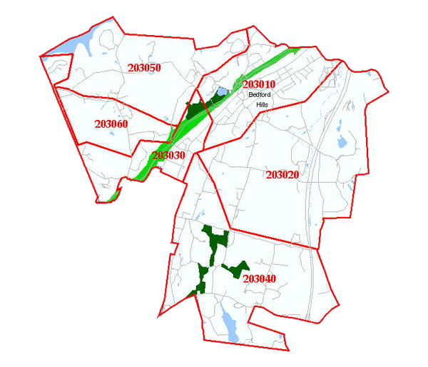
The Bedford Hills Fire District is divided into twelve designated “Box Alarm Areas,” known as Emergency Service Zones (ESZs). These zones are designed to support pre-determined mutual aid plans tailored to specific geographic areas and known hazards.
Covering approximately 17 square miles, the District is located in Westchester County and is bordered by:
-
North: Katonah Fire District
-
East: Bedford Fire District
-
South: Village of Mount Kisco
-
West: Somers Fire District (across a water boundary)
The Fire District protects approximately 17 square miles. Our first due response area is predominantly residential, but includes New York State’s only female maximum-security prison, Interstate 684 and the Saw Mill River Parkway, which are heavily traveled thoroughfares, Metro North Commuter Rail Line, multiple schools and houses of worship, many warehouses, and senior citizen developments. Additionally, our first due response area includes hundreds of acres of wooded areas and miles of nature trails purposed for recreational exercise and equestrian use. We are also in the direct landing path for Westchester County Airport (HPN).
Municipal water service is available in roughly 40% of the District. In areas without hydrants, fire suppression operations rely on rural water supply techniques.
The Fire District prides itself on successfully protecting a wide range of terrain and structures in a diverse and growing suburban environment. The fire service is constantly changing. We routinely monitor these changes and train to ensure that our operations and tactics also evolve, and we continue to operate smarter and safer.
| 


